
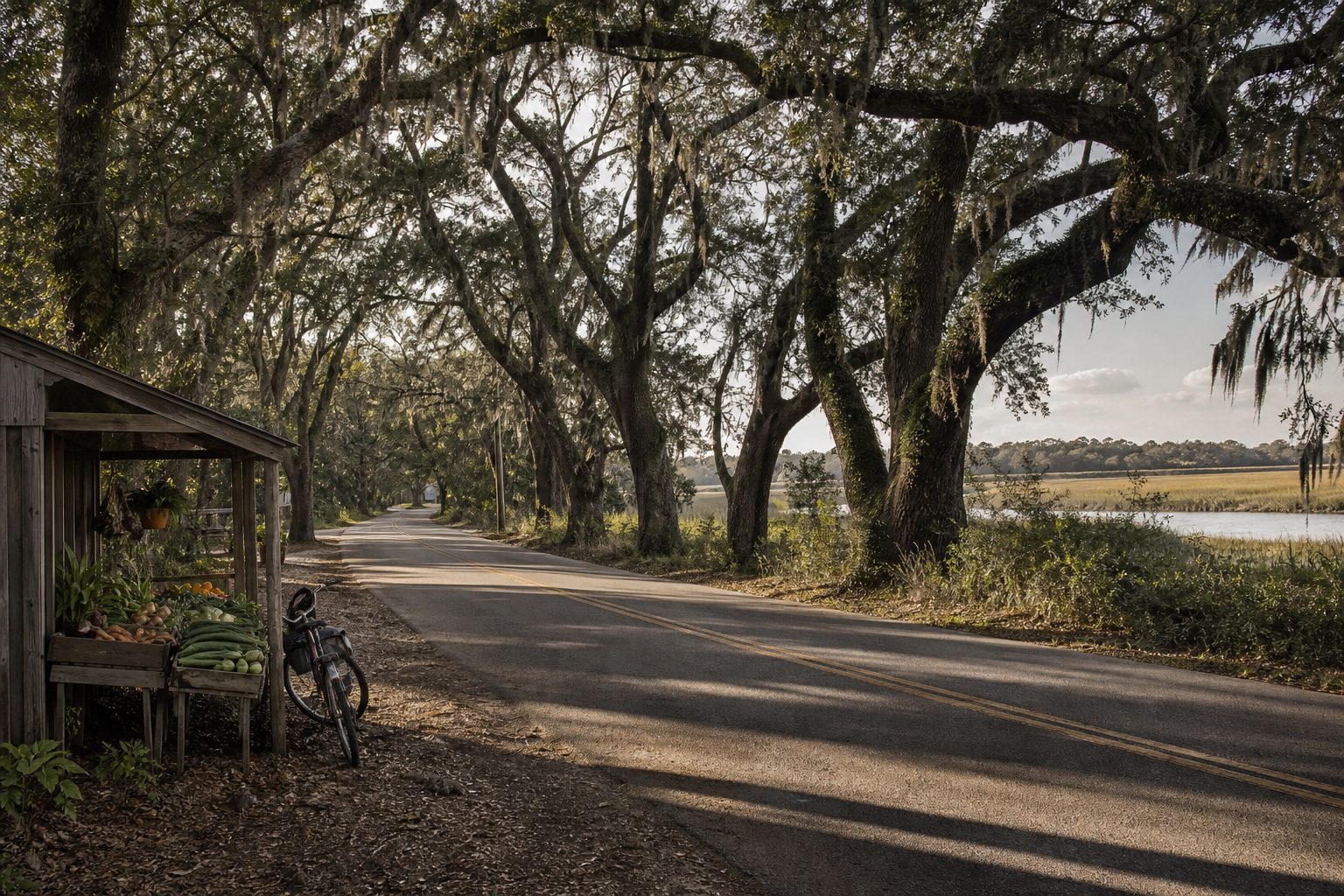
South Carolina’s Sea Islands reward a map read at close range. South of Charleston, highways narrow beside tidal creeks, live oaks close over the road, and the Atlantic disappears behind salt marsh. Bridges link the principal stops; the meaningful distances lie between beaches, working communities, historic sites, and estuaries.
Four days is enough for a coherent route from Edisto Island through Beaufort and St. Helena Island to Hunting Island. It is also slow enough to resist treating the coast as scenery alone. The islands sit within the Gullah Geechee Cultural Heritage Corridor, where descendants of West and Central Africans have sustained distinctive language, foodways, crafts, and relationships to land and water.
Follow the water, not the shortest line
Begin in Charleston, then take US 17 west before turning onto SC 174. The final 14 miles form the Edisto Island National Scenic Byway, passing woods, fields, churches, and creek crossings before reaching the island. Edisto lies about 42 miles from Charleston, but allow at least 90 minutes; the point is to arrive without turning the byway into a commute.
There is no continuous ocean road from Edisto to the Beaufort islands. On day two, retrace SC 174 to US 17, continue toward Beaufort, and use US 21 for St. Helena and Hunting islands. That apparent backtracking reveals the coast’s actual shape. The roads occupy firmer ground between the ACE Basin—named for the Ashepoo, Combahee, and Edisto rivers—and the broad marshes around St. Helena Sound.
Keep fuel above half a tank once off US 17. Mobile coverage can thin, and night driving adds deer and poorly lit junctions. Download maps and follow posted roads rather than shortcuts onto private lanes.
Day one: Edisto beyond the beach houses
Give Edisto a full day and separate the island from the town of Edisto Beach. The byway reaches a lived-in rural landscape before the final strip of vacation homes. Park only where clearly permitted.
Edisto Beach State Park is the dependable public anchor. Its 1,255 acres include Atlantic beach, maritime forest, an environmental learning center, and more than four miles of accessible walking and cycling trails. Its distinct entrances serve the beach, learning center, and Live Oak area. A high tide can compress the usable strand, while calmer early hours suit birding and beach walking.
Nearby Botany Bay Plantation Heritage Preserve adds undeveloped shoreline and a former plantation landscape. Check state access conditions and collection rules before setting out.
Stay on Edisto or near the US 17 junction. An island night preserves the byway’s quietest hours, while a mainland room shortens the next day’s drive.
Day two: Cross the basin and pause in Beaufort
The transfer to Beaufort is roughly a half-day when treated properly. Build in a stop at an official ACE Basin access point or wildlife refuge rather than pulling onto a marsh shoulder. This estuarine system is nursery, feeding, and nesting habitat; its apparent emptiness is working ecology, paced by tide rather than by a visitor timetable.
Beaufort makes the most practical two-night base. Its compact historic center can be covered on foot after the drive, and it places St. Helena Island and Hunting Island on the same US 21 corridor. The waterfront is useful for reading the geography: Beaufort River is part of the Intracoastal network, protected from the open Atlantic by successive islands.
The region’s wealth was built through enslaved labor, first around rice and indigo and later Sea Island cotton. Union occupation early in the Civil War created conditions for the Port Royal Experiment in education, paid labor, and landholding among formerly enslaved residents. Day three gives that history a specific site.
Day three: St. Helena through its institutions
Drive east on US 21 to Penn Center, allowing at least two hours and checking museum hours in advance. Founded in 1862 as Penn School, it was among the first schools in the South established for formerly enslaved people. The campus later became an important meeting place during the Civil Rights Movement; Dr. Martin Luther King Jr. and Southern Christian Leadership Conference staff worked here in the 1960s.
Penn Center remains a cultural and educational institution, not a frozen village. Begin at the welcome center, use the museum and National Park Service material to understand the campus, and remember that neighboring churches and homes serve active communities. Darrah Hall is managed as part of Reconstruction Era National Historical Park, while the wider National Historic Landmark district contains buildings with different ownership and access.
Leave the rest of the day unhurried. Small businesses along the island corridor keep variable hours, particularly outside peak season, so identify one lunch option and one backup before departure. If a sweetgrass basket, food stall, or produce stand is open, buy directly and ask before photographing people or their work. The road itself is not an open-air museum; its value lies in connecting present-day Gullah Geechee life with the institutions that preserved community memory.
Day four: Hunting Island at the Atlantic edge
Continue on US 21 to Hunting Island State Park, a barrier island where maritime forest, lagoon, marsh, and beach occupy a landscape reshaped by erosion and storms. Arrive near opening time in warm months. Parking can fill, and early light makes the forest trails and north beach more legible before midday heat.
The black-and-white Hunting Island Lighthouse reopened to visitors in May 2026 after a four-year restoration. It is South Carolina’s only publicly accessible lighthouse; climbs use 167 cast-iron steps, run in limited groups, and are weather dependent. Tickets are sold first come, first served, so treat the climb as a possibility rather than the day’s organizing promise. The structure’s history is unusually physical: assembled from cast-iron sections, it was moved inland in 1889 as erosion threatened its original site.
Afterward, choose one habitat rather than racing between all of them. Walk the beach, take a signed forest trail, or visit the nature center. Swim only with attention to posted conditions; tides, currents, heat, and sudden storms are more consequential than the modest distances suggest. Return to Beaufort before dark, or continue onward only after washing off sand and confirming the next fuel stop.
Practical brief
Best season: Late March to May and October to early November usually offer the best balance of mild temperatures and manageable insects. Summer brings heat, humidity, thunderstorms, and heavy beach demand. Atlantic hurricane season runs June through November, so monitor forecasts and park notices.
Duration: Four days, with one night on or near Edisto and two nights in Beaufort. Add a fifth day for a scheduled St. Phillips Island ferry excursion; it cannot be improvised because the island is boat-access only.
Transport: A car is essential. The core drive is approximately 180–220 miles depending on the Charleston start, Beaufort detours, and return point. No ferry is required for Edisto, St. Helena, or Hunting Island.
Budget range: US$170–320 per person per day, based on two people sharing a room and car, including lodging, meals, fuel, and park admissions. Camping can lower the total; summer weekends and whole-house rentals raise it sharply.
Carry: Refillable water, insect repellent, sun protection, shoes for shell and forest surfaces, and an offline map. Check tides, park alerts, museum hours, and severe-weather forecasts each morning.
Source note
Reporting and trip details were checked against South Carolina’s official Edisto Island guide, Edisto Beach State Park, the National Park Service guide to Penn Center, the Gullah Geechee Cultural Heritage Corridor, and Hunting Island State Park’s lighthouse update. Hours, fees, ferry schedules, trail access, and storm closures can change; verify them directly before travel.